Map of kingswood and the Parish of Bitton 1750
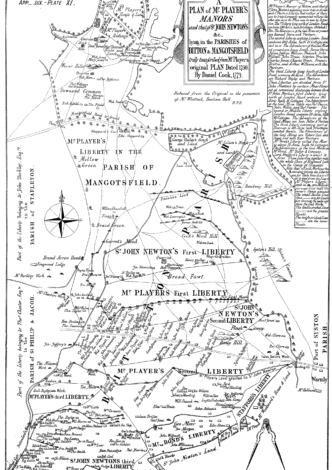
This map from 1750 is of the 'Liberties' around Kingswood and the parish of Bitton. The dotted line running out through Warmly is the London Road (now the A420). The Cock Road, not marked, is just above where “Gee Moor” is written in “Mr Bond’s Liberty”. The houses are labelled with many of the family names that are associated with the Cock Road Gang. It contains many of the family names which are associated with the Cock Road Gang such as (with various spellings) Britton, Wilmot, Ilses, Bryant, […]